

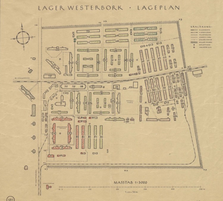
Westerbork Layout as sketched by an inmate
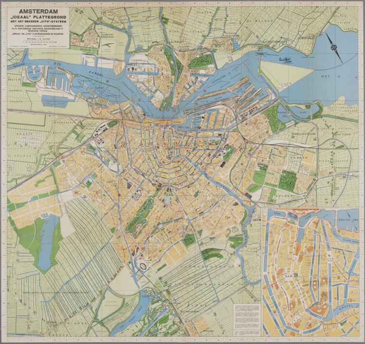
Amsterdam 1940
Amsterdam “Ideal” Map 1940
Map of Amsterdam. 5th edition. Scale 1: 15,000. Issued by N.V. Cartographia and H. van Diehlen & Co. In the lower right corner, a center bet card (scale 1:5,000).
Orientation: north north east.
Collectie Stadsarchief Amsterdam: kaarten van geheel Amsterdam
http://archief.amsterdam/archief/10035
Westerbork Transit Camp 1942
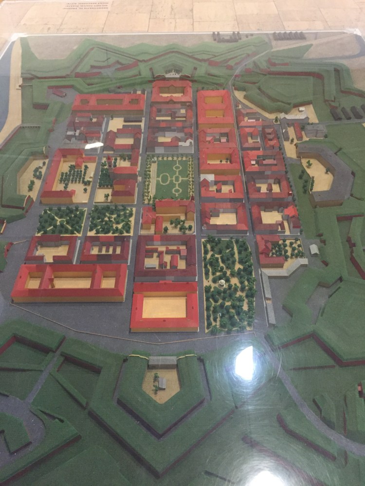
Model of Theresienstadt
This is a photo of a model of Terezín/Theresienstadt that is at the Ghetto Museum in Terezín.
